Le lac du Pêcher depuis Allanche
Add to my favorites

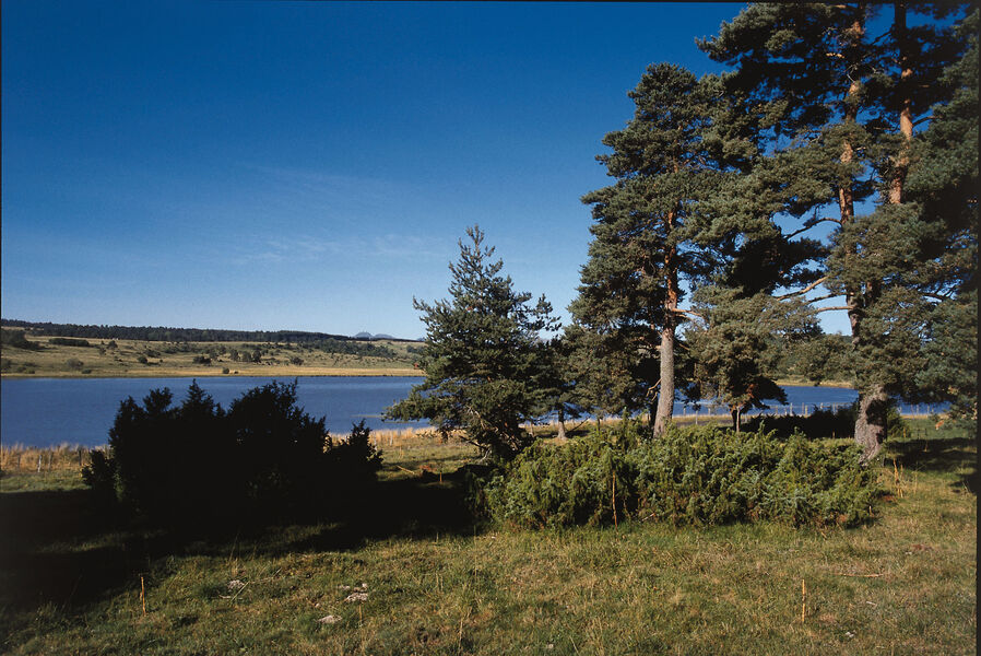
Circuit facile. Départ :place de la gare à Allanche, puis descendre l'avenue du Puy Mary. Itinéraire praticable en VTTAE (niveau bleu: modéré).
The characteristics of the route.

Allanche (15)
- Distance 22 km
- Elevation gain 400 m
- Elevation lost 410 m
- Min. elevation 946 m
- Max. elevation. 1167 m
- Duration (depending on pace) 2h30
- Marking Yes
Equipments : Parking, Admission fee : Free access.Opening : All year round.
Subject to favorable weather.
Report a problem Add a comment
Pdf file
Add your time and share your feelings
Services nearby

Allanche municipal motorhome park
Allanche

B&B - L'eau berge
Allanche
B&B - La Verte Salamandre
Allanche

Veyrond Michèle
Allanche
Hautes Terres Tourisme, Services et Découvertes - Allanche
Allanche


Information updated on 2021-01-19 by Hautes Terres Tourisme


Contact Carladès area
Carladès Tourist Office
Avenue A. Mercier
15800 Vic-sur-Cère
Tel. 04.71.47.50.68
Carladès Tourisme
tourisme@carlades.fr
![]()
Contact Hautes Terres area
Hautes Terres Tourist Office
Pl. Hôtel de ville - 15300 Murat
Tel. 04.71.20.09.47
Hautes Terres Tourisme
contact@hautesterrestourisme.fr
@hautesterrestourisme
@hautesterrestourisme


OK
Annuler