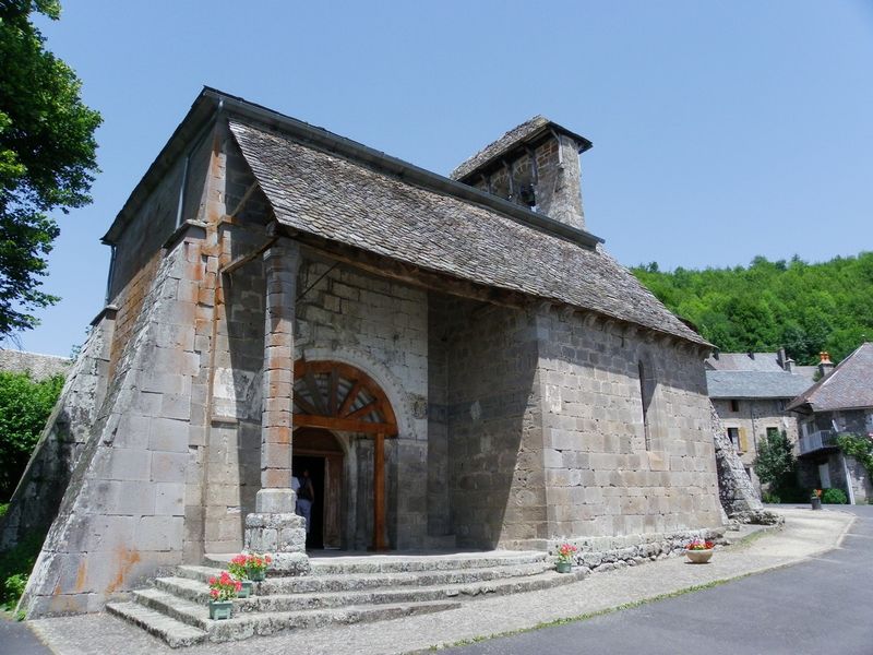
The Butte de Monjou loop
Add to my favorites

Route opened
Once on the trail, you'll discover the beautiful, gently undulating landscapes of the Goul valley and its surrounding sights (Ronesque table, Raulhac village) before reaching the Pailherols plateau, with its burons and panoramic views...
The characteristics of the route.
Jou-sous-Monjou (15)
- Distance 7.26 km
- Elevation gain 300 m
- Elevation lost 300 m
- Min. elevation 764 m
- Max. elevation. 1047 m
- Duration (depending on pace) 2h30
- Marking Yes
Start near the church in Jou sous Monjou. Head for Badailhac, then right to pass the town hall.
At the intersection, take a sharp left, then continue along the path through Lacamp to Pailherols. After taking part of the GR465 (red and white markings), you will find the "sentier du colporteur" (peddler's path), which you will follow to reach Pailherols.
Go through the village as far as the Flocons Verts gîte, then take the path to the right of the gîte towards Quiers. Turn left to reach the Pailherols cemetery and the main road. Follow it until you come to a farm building on your left, then take the path on the right that leads downhill to Cassagne.
Once at Cassagne, cross the road and take the gravel path to Canrou, then back to Jou sous Monjou.Marking : Marked in yellowEquipments : Car park, Admission fee : Free access.Opening : All year round daily. Subject to favorable snow and weather conditions.
Area : Le Lioran
Report a problem
The Butte de Monjou loop_Jou-sous-Monjou
Add your time and share your feelings
Services nearby
Gîte des Ânes à chroniques
Jou-sous-Monjou
The donkey house
Jou-sous-Monjou
Rocazel Josiane
Jou-sous-Monjou
Estelou cosy
Badailhac

L'Auberge des Montagnes
Pailherols


Information updated on 2026-05-12 by Office de Tourisme du Carladès


Follow us on
the digital trails
the digital trails


![]()
Contact
Carladès Tourist Office
Avenue A. Mercier
15800 Vic-sur-Cère
Tel. 04.71.47.50.68
Carladès Tourisme
tourisme@carlades.fr
 Espace Trail Carladès - Parcours - The Butte de Monjou loop
Hello, world! This is a toast message.
Espace Trail Carladès - Parcours - The Butte de Monjou loop
Hello, world! This is a toast message.
Espace Trail Carladès - Parcours - The Butte de Monjou loop
Hello, world! This is a toast message.


OK
Annuler