Le Rocher de la Mule
Add to my favorites

Route opened
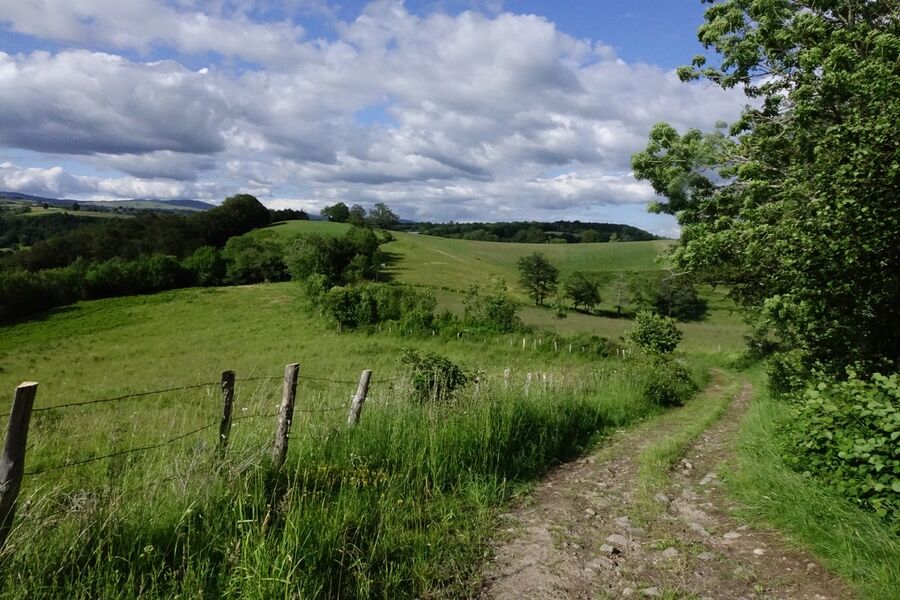
On the border between Cantal and Aveyron, this family-friendly trail takes in the characteristic architecture of the village of Raulhac (stone houses, slate roofs....), while offering fine views over the valley and the Monts du Cantal.
The characteristics of the route.
Raulhac (15)
- Distance 4.84 km
- Elevation gain 150 m
- Elevation lost 150 m
- Min. elevation 743 m
- Max. elevation. 882 m
- Duration (depending on pace) 1h30
- Marking Yes
Departure sign located at Place du Monument aux Morts.
Follow the D990 towards Pierrefort and take the path behind the cemetery.
Cross the road and take the gravel track opposite; this wide track, bordered by meadows, becomes a narrower path which then climbs back up to the D900 (a stop is recommended on the local wildlife trail).
At the road, take the path directly opposite, which climbs up through the undergrowth and joins the GR465 (outward/return route to Rocher de la Mule).
Follow the path back to the lovely viewpoint over Raulhac and the Monts du Cantal (landscape-reading table).
Continue along this path for a while before starting the descent back to the village of Raulhac.Marking : Marked in blueEquipments : Car park, Good plans : The itinerary is enhanced by wildlife interpretation panels: don't miss this stop! La balade des croix: an itinerary through the village of Raulhac, with its many crosses. Le Rocher de la Mule and its legend (QR code to be flashed on site).Admission fee : Free access.Opening : All year round daily.
Area : Raulhac
Report a problem
Le Rocher de la Mule_Raulhac
Add your time and share your feelings
Services nearby
Auberge de Raulhac
Raulhac

Chez Mimi - La Petite Maison
Raulhac
Chez Mimi - La Petite Tour
Raulhac
Chez Mimi - Triplex
Raulhac

Chez Mimi Bistrot
Raulhac


Information updated on 2025-08-18 by Office de Tourisme du Carladès


Follow us on
the digital trails
the digital trails


![]()
Contact
Carladès Tourist Office
Avenue A. Mercier
15800 Vic-sur-Cère
Tel. 04.71.47.50.68
Carladès Tourisme
tourisme@carlades.fr
 Espace Trail Carladès - Parcours - Le Rocher de la Mule
Hello, world! This is a toast message.
Espace Trail Carladès - Parcours - Le Rocher de la Mule
Hello, world! This is a toast message.
Espace Trail Carladès - Parcours - Le Rocher de la Mule
Hello, world! This is a toast message.


OK
Annuler