Las Clauzades loop
Add to my favorites

Route opened
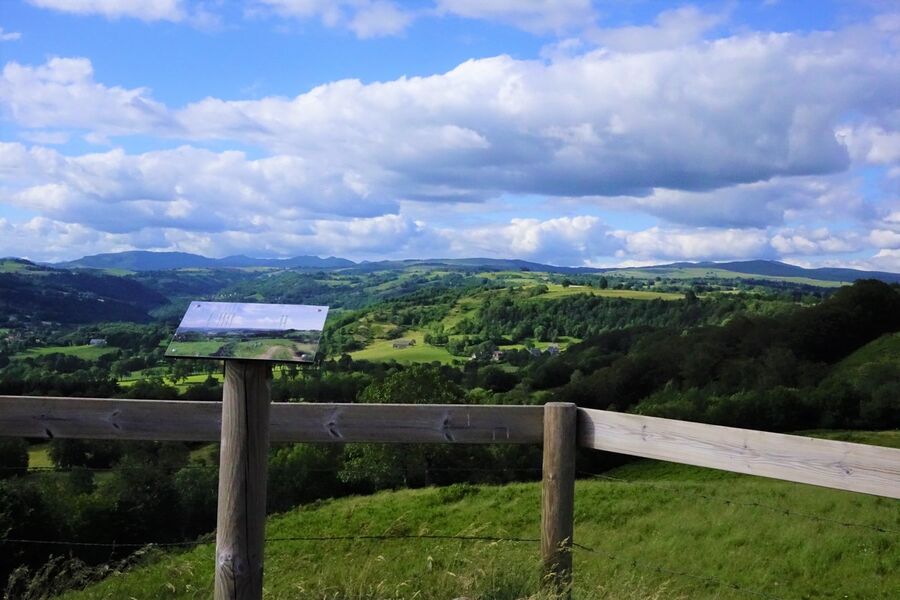
This hike offers beautiful panoramic views of the Monts du Cantal, the Goul valley and northern Aveyron, as you follow a varied trail from Raulhac, a town full of character, to the heights of the Las Clauzades basalt table.
The characteristics of the route.
Raulhac (15)
- Distance 9.61 km
- Elevation gain 250 m
- Elevation lost 250 m
- Min. elevation 732 m
- Max. elevation. 905 m
- Duration (depending on pace) 3h15
- Marking Yes
Le Rocher de la Mule owes its name to a legend from long ago, when the bishops of Saint-Flour and Rodez fought over the boundaries of their dioceses. They decided to set off from their cathedrals at a specific date and time, heading towards each other. The place where they met would be the frontier they were looking for. One on the back of a mule, the other on the back of a pig, their adventures were many, and they finally met up at the rock. The mule had run very fast for a very long time, her shoes were very hot, and when she stopped and put down her hooves, they left their marks and the rock became known as "Le Rocher de la Mule". If you look hard enough, you can still picture them...
Start sign located in the parking lot in front of the Auberge de Raulhac.
Follow the D990 towards Pierrefort. The path passes behind the cemetery and joins the road. Cross the road to take the gravel track opposite. This wide track along the edge of the meadow becomes a narrower path which then climbs back up to the D990.
Opposite, take the undergrowth path that leads to the Rocher de la Mule (200m out-and-back trip to discover the legendary Rocher de la Mule - QR code to be flashed to find out about the history of the rock).
Take the wide track back up to the viewpoint over Raulhac and the Monts du Cantal (landscape interpretation panel).
Leave the viewpoint and take the narrower path to the right. The route alternates between a forest-edge path and a wider track between meadows to reach the Rocher de Las Clauzades viewpoint.
The route continues below and around the Rocher de Las Clausades to reach the hamlet of the same name. Continue along the road until you find an undergrowth path on the left that leads back to Raulhac.Marking : Marked in yellowEquipments : Car park, Admission fee : Free access.Opening : All year round daily. Subject to favorable snow and weather conditions.
Area : Raulhac
Report a problem
Du Rocher de la Mule à Las Clauzades Du Rocher de la Mule à Las Clauzades Du Rocher de la Mule à Las Clauzades_Raulhac
Add your time and share your feelings
Services nearby

Auberge de Raulhac
Raulhac

Chez Mimi - La Petite Maison
Raulhac
Chez Mimi - La Petite Tour
Raulhac
Chez Mimi - Triplex
Raulhac

Chez Mimi Bistrot
Raulhac


Information updated on 2026-02-06 by Office de Tourisme du Carladès


Follow us on
the digital trails
the digital trails


![]()
Contact
Carladès Tourist Office
Avenue A. Mercier
15800 Vic-sur-Cère
Tel. 04.71.47.50.68
Carladès Tourisme
tourisme@carlades.fr
 Espace Trail Carladès - Parcours - Las Clauzades loop
Hello, world! This is a toast message.
Espace Trail Carladès - Parcours - Las Clauzades loop
Hello, world! This is a toast message.
Espace Trail Carladès - Parcours - Las Clauzades loop
Hello, world! This is a toast message.


OK
Annuler